How Technology Can Help Farmers Understand Their Soil?
A farmer can walk across a field and notice that one area is darker, another dries out faster, one section produces stronger crops, and another repeatedly struggles even when the same seed and fertilizer are used. The problem is that many important differences in soil are difficult to see from the surface.
Soil contains information about nutrient availability, acidity, organic matter, water-holding capacity, salinity, texture, compaction and other properties that influence crop growth. Traditional observation and laboratory soil testing remain important, but modern technology can help farmers collect more information, map differences across a field and monitor some soil conditions over time.
This is where soil technology becomes useful. Soil sensors, digital soil mapping, electrical conductivity measurements, spectroscopy, satellite and remote sensing data, GPS-based field mapping, laboratory analysis and data-analysis tools can help turn scattered soil observations into more useful information for farm decisions. FAO describes soil health through chemical, physical and biological indicators, reinforcing the fact that there is no single measurement that completely describes a soil.
The practical question is not whether technology can replace traditional soil knowledge. It is how farmers can use technology to understand where their soils differ, identify potential problems earlier, manage fertilizer and water more precisely, and make better decisions without spending money on equipment that does not solve a real farm problem.
Why Understanding Soil Properly Matters to Farmers
Farmers do not manage soil simply because soil is an agricultural resource. They manage it because soil determines how crops establish, develop roots, access water and obtain nutrients.
Two areas of the same farm can respond differently to the same fertilizer application. A sandy section may lose water more quickly than a heavier soil. A low-lying area may remain wet after rainfall while an elevated section becomes dry. A compacted zone may restrict root development. Soil acidity can affect nutrient availability, while salinity can interfere with plant water uptake and crop performance.
These differences create a management problem when a farmer treats the entire field as though it were uniform.
Traditional field knowledge can reveal many of these patterns. Farmers often know which parts of a field flood, dry out, produce better crops or become difficult to cultivate. The challenge is that observation alone may not reveal the underlying cause.
A technology-assisted approach can add measurements to that experience. Instead of simply knowing that one section performs poorly, the farmer may be able to investigate whether differences in soil moisture, pH, electrical conductivity, texture, nutrient availability, elevation or another measurable factor are associated with the problem.
That information can then support decisions about fertilizer application, irrigation, crop selection, drainage, soil amendments, field operations and future land management.
What Does Soil Technology Actually Measure?
One of the most important things farmers should understand is that different technologies measure different properties. There is no universal soil sensor that tells a farmer everything about a field.
A laboratory soil test, for example, can provide information about selected nutrients, pH, organic matter and other chemical properties. Soil moisture sensors focus on water conditions. Electrical conductivity systems can help identify spatial differences associated with soil properties such as texture, salinity and water-holding characteristics. Spectroscopy can be used to estimate multiple soil properties from the way soil interacts with electromagnetic radiation.
FAO’s current soil-information work combines field sampling, laboratory analysis, digital soil mapping and decision-support systems because reliable soil information normally comes from combining different forms of evidence rather than relying on one measurement.
The table below shows how several technologies fit into practical soil management.
| Technology | What it can help measure or reveal | Typical agricultural use |
|---|---|---|
| Laboratory soil testing | pH, available nutrients, organic matter and other selected properties | Fertility and amendment decisions |
| Soil moisture sensors | Soil water content or soil water tension | Irrigation scheduling |
| Electrical conductivity sensing | Spatial variation associated with soil properties | Management-zone mapping |
| Soil spectroscopy | Soil properties estimated from spectral signatures | Rapid soil characterization and mapping |
| GPS/GNSS mapping | Location of samples and measurements | Building accurate soil maps |
| Satellite imagery | Surface and vegetation-related spatial information | Field monitoring and identifying patterns |
| Drone sensing | High-resolution field imagery and sensor data | Detailed field investigation |
| Digital soil mapping | Predicted spatial distribution of soil properties | Site-specific farm planning |
| AI and machine learning | Analysis of multiple soil and environmental datasets | Pattern detection, prediction and decision support |
The key point is simple: technology provides measurements or estimates, while agricultural interpretation turns those measurements into decisions.
How Soil Testing Technology Helps Farmers
Conventional soil testing is already a form of agricultural technology. A farmer collects representative samples, sends them to a laboratory and receives measurements that can be interpreted for crop production.
Modern soil-management systems extend this process by making sampling, analysis, mapping and interpretation more systematic.
A soil test can help determine whether nutrients such as phosphorus and potassium are available in sufficient quantities, whether soil pH is suitable for the crop and whether other chemical conditions require attention. Soil-testing laboratories can also use standardized methods and quality-control procedures to improve the consistency of results.
For a farmer, the important issue is not simply obtaining a laboratory report. The results must be connected to the crop being grown, the field history, expected yield, fertilizer source, management system and local agronomic recommendations.
For example, discovering that a field has low nutrient availability does not automatically mean the farmer should apply a large amount of fertilizer. The appropriate response depends on the crop, soil characteristics, existing fertility, nutrient source, timing, expected crop demand and economic considerations.
Technology can improve the information available to the farmer, but it does not eliminate the need for agronomic interpretation.
Soil Sensors Can Show What Is Happening Below the Surface
Soil moisture is one of the most useful properties to monitor because irrigation decisions are often made without directly knowing how much water remains in the root zone.
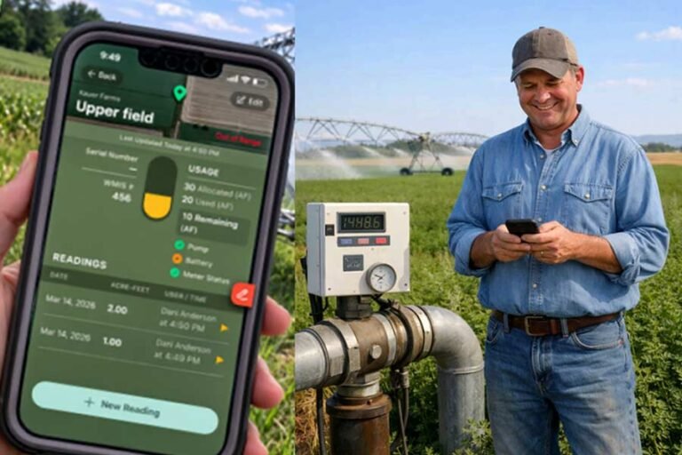
Soil moisture sensors can measure soil water content or soil water tension at selected locations and depths. When properly installed and interpreted, this information can help farmers determine when irrigation may be needed rather than relying only on a fixed calendar schedule. Extension guidance also emphasizes that sensor placement should represent different soil types and relevant parts of the crop root zone.
This is particularly useful where irrigation water is expensive, water availability is limited or fields contain significant differences in soil texture.
A sensor installed in one location, however, does not automatically describe the entire field. A sandy section and a clay-rich section may behave differently. Sensor placement, depth, calibration, soil conditions and maintenance can all affect the usefulness of the readings.
This is why soil sensing should be treated as a measurement system rather than simply buying a sensor and putting it into the ground.
What Soil Moisture Sensors Can Help Farmers Decide
A properly designed soil moisture monitoring system can contribute to decisions such as when irrigation should begin, whether the root zone has received enough water, whether irrigation is penetrating to the desired depth and whether different management zones are behaving differently.
It can also help identify situations where irrigation is being applied too frequently or insufficiently.
The technology does not determine the irrigation decision by itself. Crop stage, weather, rooting depth, irrigation-system capacity, soil water-holding characteristics and expected rainfall still matter.
Electrical Conductivity Mapping Can Reveal Soil Variability
Electrical conductivity, often abbreviated as EC, is another important measurement used in precision agriculture.
Soil electrical conductivity describes how easily an electrical current moves through soil. The reading can be influenced by factors including soil texture, water content and salts, among other properties. Because these factors vary spatially, EC mapping can help identify different management zones within a field.
Farmers can then combine EC information with soil samples, yield maps, elevation data and field observations.
This approach is useful because a map showing different EC zones is not necessarily a fertilizer prescription. It is evidence that the field may contain meaningful variation that deserves further investigation.
Research and extension work have shown how soil electrical conductivity can contribute to management-zone development for irrigation and other precision-agriculture decisions.
Soil Spectroscopy Is Making Soil Analysis More Scalable
Soil spectroscopy is an area of AgricTech receiving significant attention because it can provide information about soil properties by analyzing how soil interacts with electromagnetic radiation.
Different wavelengths can contain information related to properties such as organic carbon, texture and certain nutrient indicators. Spectroscopy can be performed in laboratories and, depending on the system, may also be used in field or proximal sensing applications.
In 2026, FAO reported work using mid-infrared spectroscopy to support faster and higher-throughput soil analysis, particularly for properties such as organic carbon and texture. The initiative is also being used to strengthen soil-information capacity in countries including Ghana, Kenya and Zambia.
This does not mean a farmer can point a handheld device at any soil and automatically receive a perfect fertilizer recommendation.
Spectroscopic systems generally depend on calibration, reference samples, analytical models and appropriate interpretation. The quality of the resulting information depends heavily on the quality and relevance of the underlying data.
Digital Soil Mapping Turns Measurements Into a Field Map
A conventional soil sample tells you about the location where the sample was collected. Digital soil mapping attempts to estimate soil properties across a larger area by combining soil observations with environmental and spatial information.
Depending on the application, that information can include:
- Soil samples
- GPS or GNSS coordinates
- Elevation
- Terrain
- Climate
- Satellite observations
- Remote sensing data
- Electromagnetic measurements
- Soil sensor readings
- Historical soil information
- Crop and field records
The resulting map can help show where soil properties are likely to vary.
This is particularly useful for precision agriculture because farmers are often interested not only in the average condition of a field, but in where conditions change within the field.
Digital soil mapping is also being developed for broader soil-information systems. FAO’s SoilFER programme combines field surveys, laboratory analysis, soil information systems, mapping and decision-support tools to turn soil data into practical agricultural information.
How Satellite Imagery and Drones Can Help Farmers Understand Soil
Satellite imagery does not directly replace a soil laboratory.
Its value often comes from identifying spatial patterns that may indicate differences in crop growth, moisture conditions, vegetation cover, drainage or other field characteristics.
For example, if one section of a field repeatedly produces weaker vegetation, satellite imagery may help identify that pattern across the whole field. The farmer can then investigate the affected area using soil samples, field observations or other measurements.
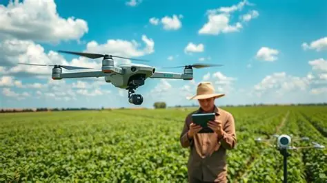
Drones can perform a similar role at a much finer spatial resolution when appropriate cameras or sensors are available.
The important distinction is between detecting a pattern and identifying its cause.
Aerial imagery may show that plants are performing poorly in a particular zone. It may not tell the farmer whether the underlying cause is nutrient deficiency, waterlogging, compaction, pest pressure, disease, poor establishment or another problem.
Ground verification remains important.
Artificial Intelligence Can Help Connect Soil Data
Artificial intelligence and machine learning can become useful when farmers or agricultural professionals have large quantities of data that are difficult to interpret manually.
A system can combine soil samples, sensor measurements, weather records, field locations, crop observations, remote-sensing information and historical farm data to identify patterns or estimate soil properties.
Recent research is exploring AI-assisted soil monitoring at multiple scales, including the combination of sensors, spectroscopy, geophysical measurements, drones and satellite observations. However, researchers also identify challenges involving limited ground-truth data, differences between environments and uncertainty in predictions.
This distinction matters because an AI-generated soil map is still a model.
If the input data is incomplete or does not represent the farm properly, the output may be less reliable than it appears.
AI can therefore help farmers ask better questions of their data, but it should not be treated as an unquestionable soil expert.
From Soil Data to a Practical Farm Decision
The real value of soil technology appears when information changes a farming decision.
Consider a hypothetical maize farm where the farmer notices that one portion of the field consistently produces weaker plants.
The farmer could begin by reviewing the field history and collecting representative soil samples. Soil testing might identify differences in pH or nutrient availability. Soil moisture measurements could show that the affected area dries more quickly. An EC survey might reveal a broader spatial pattern. Satellite imagery could show that the same zone has experienced weaker vegetation over several seasons.
The farmer could then combine these findings with field inspection.
If the evidence points toward a soil-related problem, the farmer may be able to manage the affected area differently rather than applying the same treatment to the entire field.
The technology has not made the decision. It has improved the evidence available for making the decision.
A Practical Soil Technology Workflow for Farmers
A sensible technology-assisted soil-management process usually starts with the problem rather than the equipment.
| Step | What the farmer does | Technology’s role |
|---|---|---|
| Identify the problem | Observe poor growth, uneven yield, excessive dryness or another issue | Helps define what should be measured |
| Collect baseline information | Review field history and existing soil records | Digital records can organize information |
| Sample the soil | Collect representative samples | GPS can record sampling locations |
| Test important properties | Use an appropriate laboratory or validated sensing method | Laboratory and sensing technologies provide measurements |
| Map variation | Compare samples and spatial information | GIS, EC mapping and digital soil mapping can reveal patterns |
| Monitor changes | Track moisture or other selected variables | Sensors can provide repeated measurements |
| Interpret results | Compare information with crop and field conditions | Data-analysis tools can assist |
| Make a management decision | Adjust fertilizer, irrigation, crop choice or another practice where justified | Decision-support systems can help evaluate information |
| Review the outcome | Compare crop response with previous conditions | Digital records help build a farm-specific history |
This approach prevents a common mistake: purchasing sophisticated equipment before determining what information the farm actually needs.
What Equipment Might a Farmer Need?
The equipment required depends entirely on the soil question being investigated.
A farmer interested mainly in fertility may need representative sampling equipment and access to a reliable soil laboratory rather than an expensive sensor system.
A farmer managing irrigated crops may benefit more from soil moisture monitoring.
A large commercial farm with significant variation across fields may have a stronger reason to investigate EC mapping, GPS-based sampling, digital soil maps and precision-management zones.
A research organization, soil-testing laboratory or specialist service provider may use more advanced technologies such as spectroscopy, portable analytical instruments or integrated sensing platforms.
The important principle is that the technology should match the decision.
| Farm situation | Technology that may be useful | Main consideration |
|---|---|---|
| Small farm with limited technology budget | Laboratory soil testing, basic field records, simple moisture monitoring | Keep the system affordable and understandable |
| Irrigated vegetable farm | Soil moisture sensors and soil testing | Correct placement and frequent interpretation matter |
| Medium commercial crop farm | GPS soil sampling, EC mapping, digital records | Spatial variability must justify the additional cost |
| Large precision-agriculture operation | Multiple sensors, mapping, remote sensing and decision-support tools | Data integration and technical support become important |
| Farm with poor connectivity | Offline-capable tools, local data collection and periodic data transfer | Do not build the system around permanent internet access |
| Farm without technical support | Professional soil-testing or mapping services | Service-based adoption may be more practical than ownership |
How Much Does Soil Technology Cost?
There is no single price for soil technology because the category includes everything from laboratory soil tests to sophisticated field-sensing systems.
The cost can include sampling, laboratory analysis, sensors, GPS equipment, data loggers, mapping, software, connectivity, installation, calibration, technical services, maintenance and interpretation.
Recent research on proximal soil sensing shows that costs vary substantially according to the sensing method and whether the service includes fieldwork, analysis and reporting. This is one reason it is more useful to compare the total cost of obtaining usable soil information rather than comparing the purchase price of a sensor alone.
For many farms, hiring a soil-mapping or sensing service may be more practical than purchasing specialized equipment.
A service provider may already have the sensor, mapping software, technical expertise and data-processing capability. The farmer pays for the information or service instead of carrying the full cost of equipment ownership.
The correct economic question is therefore not simply, “How much does this sensor cost?”
It is:
What decision will this information improve, and is the expected value of better decision-making sufficient to justify the total cost?
Can Technology Tell Farmers Everything About Their Soil?
No.
This is one of the most important limitations to understand.
Soil is a complex biological, chemical and physical system. A sensor reading can represent one property or provide an indirect indication of several related properties, but it does not necessarily explain every process occurring in the soil.
For example, a moisture sensor can tell a farmer something about water conditions at its measurement point. It does not automatically explain why a crop is struggling.
Similarly, an EC map can identify spatial variation, but additional sampling and interpretation may be needed to determine what causes that variation.
Digital soil maps also contain uncertainty because their predictions depend on the quality and representativeness of the input data and the model used. Recent reviews of digital soil mapping emphasize the importance of uncertainty assessment rather than treating mapped predictions as exact measurements.
Why Soil Sampling Still Matters
Modern sensing technology has not made physical soil sampling irrelevant.
In many systems, soil samples provide the reference information needed to calibrate, validate or interpret sensor measurements and digital maps.
This is especially important when using technologies that estimate soil properties indirectly.
A good soil-management programme may therefore use both approaches:
Sampling provides direct evidence at selected locations, while sensing and mapping help understand how conditions vary between those locations.
This combination can be much more informative than relying exclusively on either a handful of samples or a sensor map without ground verification.
Common Mistakes Farmers Should Avoid
One common mistake is assuming that an expensive sensor automatically produces better farm decisions.
Another is placing too much confidence in a measurement without understanding what it actually represents.
Poor sensor placement can produce misleading readings. Poor soil sampling can produce misleading laboratory results. A model trained using data from another environment may not perform equally well on a different soil, climate or production system.
Farmers should also avoid interpreting a technology-generated map as a fertilizer prescription without appropriate agronomic analysis.
The technology should support investigation, not eliminate it.
Soil Technology in Nigeria and Africa
The practical case for soil technology in Africa is closely connected to the need for better local soil information.
Agricultural fields can vary considerably in soil properties, climate, water availability, management history and production systems. Digital soil mapping initiatives across Africa have also faced challenges including limited sampling density, incomplete datasets and problems with the availability and quality of environmental information used by models.
For Nigerian farmers, this means technology designed for a highly mechanized farm in another country should not automatically be assumed to work in the same way locally.
A practical system needs to consider local soils, crops, rainfall patterns, farm sizes, connectivity, electricity, technical support, equipment availability and farmer skills.
For a smallholder, paying for a professional soil-testing or mapping service may make more sense than purchasing specialized sensing equipment.
For a large commercial farm, however, repeated soil mapping and sensor monitoring may become more useful where substantial differences within fields affect fertilizer, irrigation or crop-management decisions.
The same technology can therefore make sense for one farm and make little economic sense for another.
New Developments in Digital Soil Management
Soil technology is moving beyond isolated measurements toward integrated soil-information systems.
FAO’s current SoilFER work is an example of this direction. It connects field sampling, laboratory analysis, digital soil mapping, soil information systems and decision-support tools. In 2026, FAO also launched CropSuit, a digital application that combines soil, climate, landscape and other environmental information to help identify crops suited to particular locations.
Another important development is the use of spectroscopy and other sensing technologies to process larger numbers of soil samples more efficiently. FAO reported in 2026 that mid-infrared spectroscopy is being used to strengthen soil-monitoring capacity and generate soil information more efficiently.
Research is also increasingly combining sensor data with machine learning and other analytical methods to produce higher-resolution information about soil variability. These systems remain dependent on good reference data, appropriate validation and understanding of local conditions.
The direction is therefore not simply toward more sensors. It is toward better integration of soil observations, laboratory data, spatial information and farm-management decisions.
When Is Soil Technology Worth Considering?
Technology becomes more useful when the farmer has a clear decision problem that better soil information could improve.
It may be particularly relevant where a farm has substantial variability, irrigation costs are significant, fertilizer application needs to be more targeted, soil problems are difficult to diagnose visually, or the farm is already collecting digital production data.
It may be less useful when the farm is small, soil conditions are relatively uniform, basic soil testing is not being performed, or the farmer does not yet have a management decision that requires more detailed information.
A sophisticated system cannot compensate for poor basic soil management.
In some situations, a well-collected soil sample and a reliable laboratory report may provide more useful information than a complicated sensor platform.
How Farmers Can Start Using Soil Technology
The safest starting point is to identify a specific soil-management problem.
A farmer might ask:
“Why does this part of the field repeatedly yield less?”
“Why does this section dry out before the rest of the field?”
“Why does irrigation remain excessive in some areas?”
“Why does fertilizer appear to produce different crop responses across the field?”
Once the question is clear, the farmer can determine what information is needed to investigate it.
The next step is to establish a baseline using field observations, historical records and appropriate soil sampling. Only then should the farmer decide whether sensors, mapping, remote sensing or another technology adds enough information to justify its cost.
Start with a manageable area, verify the results and record what happens after the management change.
If the information consistently improves decisions, the system can be expanded.
What Farmers Should Ask Before Buying Soil Technology
Before purchasing a soil sensor, mapping system or digital soil platform, farmers should ask what the device actually measures and whether the measurement is direct or estimated.
They should also ask how the system is calibrated, what soil types it has been tested on, how often it needs maintenance, whether it requires internet access, what happens when connectivity fails, how data is stored, who owns the data, whether technical support is available locally and what happens if the device stops working.
For sensor-based systems, installation is particularly important. Soil moisture sensor guidance, for example, emphasizes representative placement at relevant depths and locations rather than treating one sensor position as representative of an entire field.
Farmers should also ask what decision the technology is designed to improve.
If the provider cannot clearly explain how the information will be translated into a farm-management decision, the technology may not be solving a sufficiently defined problem.
The Most Useful Soil Technology Is the One That Improves a Real Decision
Technology can make soil easier to measure, map and monitor, but understanding soil is still more than collecting numbers.
A farmer needs to connect measurements with crop behaviour, field history, weather, water management, fertilizer use, cultivation practices and observed conditions.
The strongest approach is therefore a combination of agricultural knowledge and technology.
Laboratory testing can provide chemical information. Sensors can monitor moisture. EC mapping can reveal spatial patterns. Remote sensing can show changes across a field. Digital soil mapping can extend observations across larger areas. AI can help analyze complex datasets.
But the final value comes from using that information to make a sound agricultural decision.
For farmers, the goal should not be to collect the largest amount of soil data. The goal should be to collect useful, reliable information that helps manage soil more effectively.
Frequently Asked Questions
How can technology help farmers understand their soil?
Technology can help farmers measure or estimate properties such as soil moisture, pH, nutrient availability, organic matter, texture and spatial variability. Soil sensors, laboratory testing, spectroscopy, EC mapping, satellite data and digital soil mapping can provide different pieces of information that can be combined for better farm decisions.
What technology is used for soil testing?
Depending on the purpose, farmers may use conventional laboratory analysis, soil moisture sensors, electrical conductivity sensors, spectroscopy, GPS-based sampling, digital soil mapping and other proximal sensing technologies. Each method measures different properties and has different accuracy, cost and infrastructure requirements.
Can soil sensors replace laboratory soil testing?
Usually, they should not be treated as a universal replacement. Some sensors provide direct measurements of particular soil conditions, while others estimate properties indirectly. Laboratory testing remains an important source of reference information, particularly for soil fertility assessment and calibration or validation of some sensing systems.
Can technology show differences within the same farm?
Yes. GPS-based sampling, EC mapping, soil sensors, remote sensing and digital soil mapping can help identify spatial differences within fields. These differences can then be investigated further to determine whether they are related to soil texture, moisture, fertility, drainage, salinity or other conditions.
Are soil moisture sensors useful for small farms?
They can be useful where irrigation management is important, but the economics depend on the farm, crop, irrigation system and sensor cost. Small farms may find it more practical to use simple monitoring tools or obtain soil-monitoring services rather than install a large sensor network.
Can AI analyze soil data?
AI and machine-learning systems can analyze combinations of soil, environmental and spatial data to identify patterns and make predictions. Their usefulness depends on the quality and relevance of the underlying data, model validation and local conditions.
Does soil technology require internet access?
Not necessarily. Some measurement devices can collect data locally and transfer it later. However, cloud-based dashboards, remote monitoring systems, digital advisory platforms and some mapping services may require connectivity. Farmers should check the system’s offline capabilities before adopting it.
How should farmers choose soil technology?
Farmers should begin with the agricultural problem they want to solve. They should then identify the required soil information, compare available measurement methods, consider total costs and infrastructure, check calibration and validation requirements, and determine whether technical support is available. Buying technology before defining the problem can lead to unnecessary expense.